Skip to the page
Forestline

Rubber · Near the Edo and Delta border, Edo

Rubber estate named Pamol Rubber Plantation, Edo

A large rubber estate near the Edo and Delta border, checked as 4 blocks. Three blocks need a person to look and one is Stop. Rubber estates fell and replant, so the loss record is large here. Its shipment is blocked.

  • 4 blocks, 2,689.1 hectares
  • 3 Check, 1 Stop
  • No proof pack: no block is ready for the EU buyer
  • Shipment S-001: Blocked: not for your EU buyer. Take lot L-001 out of this shipment, or resolve its farms first.
  • Edge from OpenStreetMap, imported from a names database. Not a survey.
  • Weights are estimates. No bags were bought.
  • Rubber estates replant, so tree loss here is not always forest cut.
  • Nobody has approved any shipment for an EU buyer.

The story

How this case was run.

The estate that OpenStreetMap names "Pamol Rubber Plantation", near the Edo and Delta border.

Its extent is an import from a names database (GNS). It is not a surveyed edge. Forestline used its 4 outer rings as 4 blocks, 2,689 hectares in all. It ignored the 5 holes OpenStreetMap lists inside it. The owner is not named and was not contacted.

This case shows Replant or Clear. Rubber estates fell old trees and plant again. So the loss record shows about 511 hectares of tree loss after 2020. Almost all of it is on land the EU 2020 forest map does not call forest. Forestline AI reads the photos for replanting. It sees rubber rows in both photos of every block, and reads old trees cut and planted again on all four: with high confidence on blocks 1 and 3, and with medium confidence on blocks 2 and 4. A person must look at every Check.

Blocks 1, 3 and 4 are Check. Block 2 is Stop. On 0.62 hectares of block 2, land that the EU 2020 map calls forest lost its trees in 2021 and 2022. That is 0.3% of the block. But the rule stops a farm at 0.5 hectares, whatever its size. Forestline AI read old rubber cut and planted again there, with medium confidence, and noted cloud and shadow over part of the second photo. Only a high-confidence replanting reading can lower a Stop, so block 2 stays Stop and a person must look.

No block is Clear and nobody has reviewed a Check. So no proof pack is built, and every bag is kept apart from the EU lot.

No bags were bought from this estate. The weights are estimates: each block's area times 1,000 kg a hectare a year, the published average for rubber. They are not records of any sale.

Shipment S-001 holds lot L-001 (2,689,098 kg, estimated). It is blocked: not for an EU buyer. Lot L-001 (2,689,098 kg) is not kept apart: 4 bag groups trace to a plot that is not cleared. Mixed goods cannot be fixed by leaving plots out of the farm location file. Take lot L-001 out of this shipment, or resolve its farms first. No one has approved any shipment for an EU buyer.

Read this first

Farm edge from OpenStreetMap. The owner was not contacted and is not a Forestline customer.

Map data and farm edges: OpenStreetMap contributors, ODbL 1.0.

Satellite photos: Copernicus Sentinel-2. Forest records: EU Joint Research Centre and University of Maryland.

The farms

4 farms · 2,689.1 ha · 0 Clear · 3 Check · 1 Stop

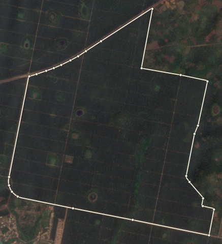
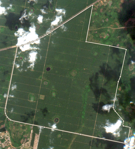
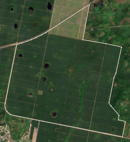
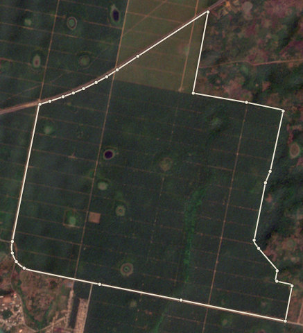
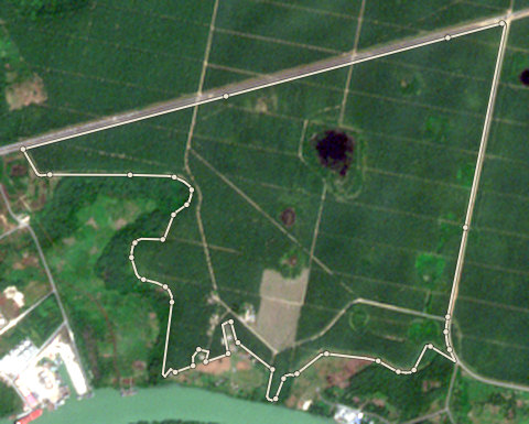
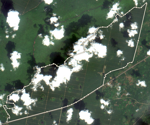
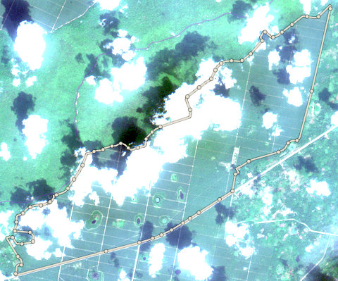
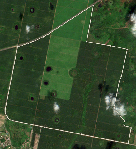
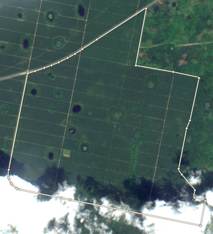
Plot EDO-PML-0002: the latest selected photoPlot EDO-PML-0002: the nearest photo to the cut-off
⇄
Nearest photo to the cut-off · 2021-02-11Latest selected photo · 2025-12-04
Stop

EDO-PML-0002 · 211.6 ha

0.62 hectares of this plot was forest at the end of 2020 and has lost its trees in 2021 and 2022. That is less than 1% of the plot. Do not buy from it for the EU.

Plot codeAreaResultMain reason
EDO-PML-0001756.5 haCheck61.7 hectares lost trees after 2020 on land the EU 2020 map does not call forest. Often this is old rubber or cocoa cut and planted again. Ask for the planting year and proof. Forestline AI: Both photos show a large rubber plantation with regular rows and a grid of internal roads. The 2020 photo has some cloud at the bottom edge but the plantation is clearly visible. In the recent photo, some blocks appear lighter green, suggesting younger rubber trees, consistent with 61.7 ha of tree loss recorded since 2020, likely replanting of older rubber blocks.
EDO-PML-0002211.6 haStop0.62 hectares of this plot was forest at the end of 2020 and has lost its trees in 2021 and 2022. That is less than 1% of the plot. Do not buy from it for the EU.
EDO-PML-0003285.4 haCheck12.8 hectares lost trees after 2020 on land the EU 2020 map does not call forest. Often this is old rubber or cocoa cut and planted again. Ask for the planting year and proof. Forestline AI: Both photos show a large rubber plantation with regular rows covering most of the plot. Some small patches inside the farm edge appear darker or cleared in the recent photo, matching about 12.8 hectares of tree loss recorded since 2020. The overall plantation structure remains the same.
EDO-PML-00041435.6 haCheck430 hectares lost trees after 2020 on land the EU 2020 map does not call forest. Often this is old rubber or cocoa cut and planted again. Ask for the planting year and proof. Forestline AI: The 2020 photo has heavy cloud cover over much of the plot, but where visible it shows a regular grid of plantation rows consistent with rubber. The latest selected photo is clear and shows large rectangular blocks of rubber plantation at different growth stages, with a road on the right side. Some blocks appear younger (lighter green) than others, suggesting older rubber was cleared and replanted in parts of the plot.

Farm by farm

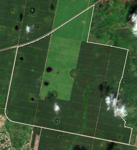
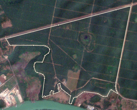
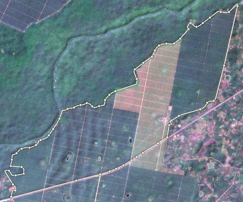
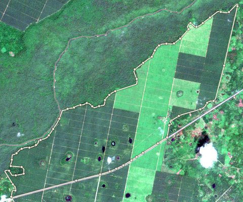
Plot EDO-PML-0001: the latest selected photoPlot EDO-PML-0001: the 2020 photo
⇄
2020 photo · 2020-11-03Latest selected photo · 2025-12-04

2020 photo: scene S2B_31NGG_20201103_0_L2A, clouds 11%. Latest selected photo: scene S2A_31NGG_20251204_0_L2A, taken 2025-12-04, clouds 0%.

A forest alert is newer than this photo (2026-02-15). The photo may not show it.
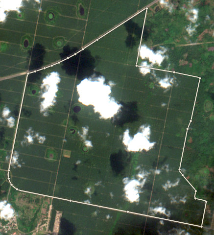
Photo timeline
  1. Satellite photo of farm EDO-PML-0001 taken 8 Dec 2020

    2020-21

    8 Dec 2020

  2. Satellite photo of farm EDO-PML-0001 taken 22 Jan 2022

    2021-22

    22 Jan 2022

  3. Satellite photo of farm EDO-PML-0001 taken 18 Dec 2022

    2022-23

    18 Dec 2022

  4. Satellite photo of farm EDO-PML-0001 taken 18 Dec 2023

    2023-24

    18 Dec 2023

  5. Satellite photo of farm EDO-PML-0001 taken 11 Jan 2025

    2024-25

    11 Jan 2025

  6. Satellite photo of farm EDO-PML-0001 taken 4 Dec 2025

    2025-26

    4 Dec 2025

EDO-PML-0001

Check

756.53 ha · farm edge from OpenStreetMap

  • 61.7 hectares lost trees after 2020 on land the EU 2020 map does not call forest. Often this is old rubber or cocoa cut and planted again. Ask for the planting year and proof. Forestline AI: Both photos show a large rubber plantation with regular rows and a grid of internal roads. The 2020 photo has some cloud at the bottom edge but the plantation is clearly visible. In the recent photo, some blocks appear lighter green, suggesting younger rubber trees, consistent with 61.7 ha of tree loss recorded since 2020, likely replanting of older rubber blocks.
  • Satellite alerts show about 1.6 hectares of new tree loss in this plot since 2021. The latest alert is from 2026. A person must look at the latest selected photo.

Forestline AI's reading

Both photos show a large rubber plantation with regular rows and a grid of internal roads. The 2020 photo has some cloud at the bottom edge but the plantation is clearly visible. In the recent photo, some blocks appear lighter green, suggesting younger rubber trees, consistent with 61.7 ha of tree loss recorded since 2020, likely replanting of older rubber blocks.

Proof to gather: Replanting records or schedule from the estate manager; Receipts for rubber seedlings purchased since 2020; Photos of the replanted blocks showing young rubber trees; Age map of rubber blocks across the plantation; Cooperative or company records confirming replanting, not forest clearing.

Sources: EU Joint Research Centre Global Forest Cover 2020 (V4); University of Maryland Global Forest Change (loss counts are a rough guide, not an exact area) (GFC-2025-v1.13); Global Forest Watch integrated deforestation alerts (latest release); Copernicus Sentinel-2 satellite photos, through Earth Search (S2B_31NGG_20201103_0_L2A (baseline 02.14); S2A_31NGG_20251204_0_L2A (baseline 05.11)); OpenStreetMap protected areas (partial coverage; not a legal map) (snapshot b0efa2a7, 11 areas); Forestline AI photo reading (reads the two photos; the rules decide the result) (Photo reader version 1)
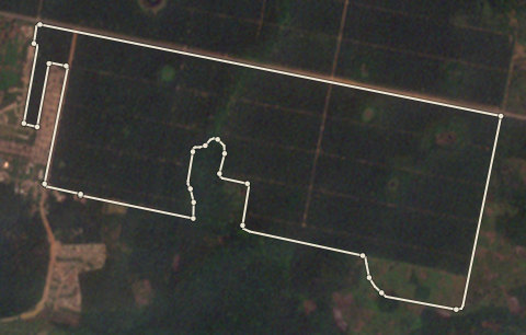
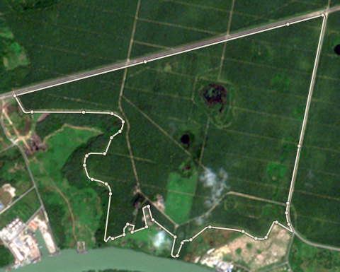
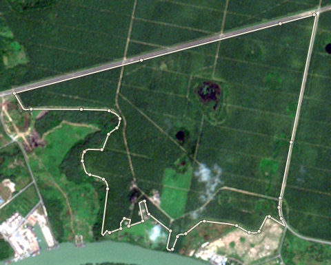
Plot EDO-PML-0002: the latest selected photoPlot EDO-PML-0002: the nearest photo to the cut-off
⇄
Nearest photo to the cut-off · 2021-02-11Latest selected photo · 2025-12-04

Nearest photo to the cut-off: scene S2B_31NGG_20210211_1_L2A, clouds 0%. Latest selected photo: scene S2A_31NGG_20251204_0_L2A, taken 2025-12-04, clouds 0%.

Photo timeline
  1. Satellite photo of farm EDO-PML-0002 taken 11 Feb 2021

    2020-21

    11 Feb 2021

  2. Satellite photo of farm EDO-PML-0002 taken 22 Jan 2022

    2021-22

    22 Jan 2022

  3. Satellite photo of farm EDO-PML-0002 taken 18 Nov 2023

    2023-24

    18 Nov 2023

  4. Satellite photo of farm EDO-PML-0002 taken 11 Jan 2025

    2024-25

    11 Jan 2025

  5. Satellite photo of farm EDO-PML-0002 taken 4 Dec 2025

    2025-26

    4 Dec 2025

EDO-PML-0002

Stop

211.59 ha · farm edge from OpenStreetMap

  • 0.62 hectares of this plot was forest at the end of 2020 and has lost its trees in 2021 and 2022. That is less than 1% of the plot. Do not buy from it for the EU.
  • 6.2 hectares lost trees after 2020 on land the EU 2020 map does not call forest. Often this is old rubber or cocoa cut and planted again. Ask for the planting year and proof. Forestline AI: Both photos show a large rubber plantation with regular rows covering most of the plot. In the current photo, several brown or bare strips appear inside the rows, suggesting sections of rubber trees were cut down. Cloud and cloud shadows cover parts of the current photo but most of the plot is still visible. The overall plantation structure remains.

Forestline AI's reading

Both photos show a large rubber plantation with regular rows covering most of the plot. In the current photo, several brown or bare strips appear inside the rows, suggesting sections of rubber trees were cut down. Cloud and cloud shadows cover parts of the current photo but most of the plot is still visible. The overall plantation structure remains.

Proof to gather: Year the rubber was originally planted; Replanting schedule or plan from the estate manager; Receipts for new rubber seedlings; Photos of the cleared sections showing young replanting; Cooperative or estate records confirming replanting activity.

Sources: EU Joint Research Centre Global Forest Cover 2020 (V4); University of Maryland Global Forest Change (loss counts are a rough guide, not an exact area) (GFC-2025-v1.13); Global Forest Watch integrated deforestation alerts (latest release); Copernicus Sentinel-2 satellite photos, through Earth Search (S2B_31NGG_20210211_1_L2A (baseline 05.00); S2A_31NGG_20251204_0_L2A (baseline 05.11)); OpenStreetMap protected areas (partial coverage; not a legal map) (snapshot b0efa2a7, 11 areas); Forestline AI photo reading (reads the two photos; the rules decide the result) (Photo reader version 1)
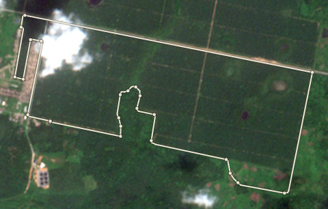
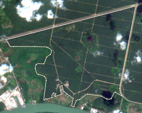
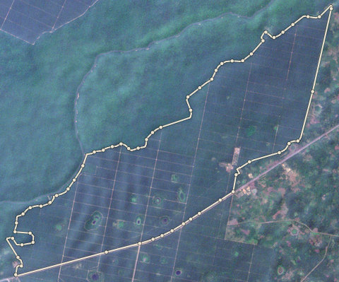
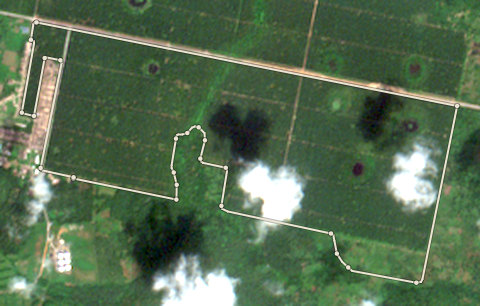
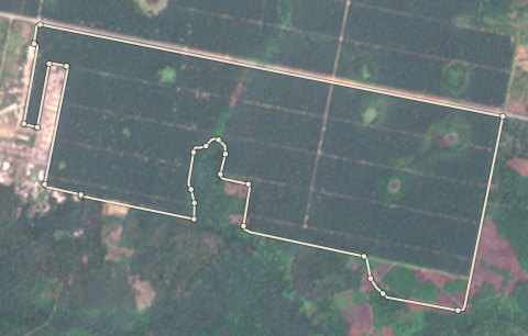
Plot EDO-PML-0003: the latest selected photoPlot EDO-PML-0003: the 2020 photo
⇄
2020 photo · 2020-12-08Latest selected photo · 2025-12-04

2020 photo: scene S2A_31NGG_20201208_0_L2A, clouds 2%. Latest selected photo: scene S2A_31NGG_20251204_0_L2A, taken 2025-12-04, clouds 0%.

Photo timeline
  1. Satellite photo of farm EDO-PML-0003 taken 8 Dec 2020

    2020-21

    8 Dec 2020

  2. Satellite photo of farm EDO-PML-0003 taken 18 Dec 2023

    2023-24

    18 Dec 2023

  3. Satellite photo of farm EDO-PML-0003 taken 11 Jan 2025

    2024-25

    11 Jan 2025

  4. Satellite photo of farm EDO-PML-0003 taken 4 Dec 2025

    2025-26

    4 Dec 2025

EDO-PML-0003

Check

285.37 ha · farm edge from OpenStreetMap

  • 12.8 hectares lost trees after 2020 on land the EU 2020 map does not call forest. Often this is old rubber or cocoa cut and planted again. Ask for the planting year and proof. Forestline AI: Both photos show a large rubber plantation with regular rows covering most of the plot. Some small patches inside the farm edge appear darker or cleared in the recent photo, matching about 12.8 hectares of tree loss recorded since 2020. The overall plantation structure remains the same.
  • Satellite alerts show about 5.2 hectares of new tree loss in this plot since 2021. The latest alert is from 2024. A person must look at the latest selected photo.

Forestline AI's reading

Both photos show a large rubber plantation with regular rows covering most of the plot. Some small patches inside the farm edge appear darker or cleared in the recent photo, matching about 12.8 hectares of tree loss recorded since 2020. The overall plantation structure remains the same.

Proof to gather: year the rubber was originally planted; replanting schedule or block plan from the estate; receipts for new rubber seedlings or budwood; photos of the replanted blocks showing young trees; cooperative or estate records confirming replanting not forest clearing.

Sources: EU Joint Research Centre Global Forest Cover 2020 (V4); University of Maryland Global Forest Change (loss counts are a rough guide, not an exact area) (GFC-2025-v1.13); Global Forest Watch integrated deforestation alerts (latest release); Copernicus Sentinel-2 satellite photos, through Earth Search (S2A_31NGG_20201208_0_L2A (baseline 02.14); S2A_31NGG_20251204_0_L2A (baseline 05.11)); OpenStreetMap protected areas (partial coverage; not a legal map) (snapshot b0efa2a7, 11 areas); Forestline AI photo reading (reads the two photos; the rules decide the result) (Photo reader version 1)
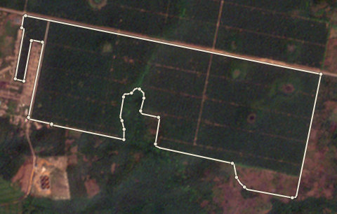
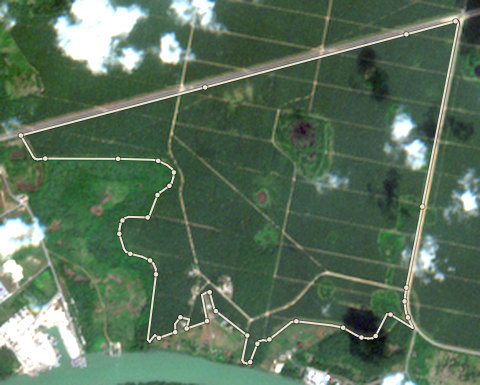
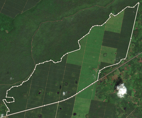
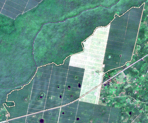
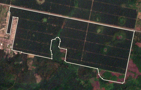
Plot EDO-PML-0004: the latest selected photoPlot EDO-PML-0004: the 2020 photo
⇄
2020 photo · 2020-12-08Latest selected photo · 2025-12-04

2020 photo: scene S2A_31NGG_20201208_0_L2A, clouds 10%. Latest selected photo: scene S2A_31NGG_20251204_0_L2A, taken 2025-12-04, clouds 0%.

A forest alert is newer than this photo (2026-02-15). The photo may not show it.

Photo timeline
  1. Satellite photo of farm EDO-PML-0004 taken 8 Dec 2020

    2020-21

    8 Dec 2020

  2. Satellite photo of farm EDO-PML-0004 taken 22 Jan 2022

    2021-22

    22 Jan 2022

  3. Satellite photo of farm EDO-PML-0004 taken 18 Dec 2023

    2023-24

    18 Dec 2023

  4. Satellite photo of farm EDO-PML-0004 taken 11 Jan 2025

    2024-25

    11 Jan 2025

  5. Satellite photo of farm EDO-PML-0004 taken 4 Dec 2025

    2025-26

    4 Dec 2025

EDO-PML-0004

Check

1435.61 ha · farm edge from OpenStreetMap

  • 430 hectares lost trees after 2020 on land the EU 2020 map does not call forest. Often this is old rubber or cocoa cut and planted again. Ask for the planting year and proof. Forestline AI: The 2020 photo has heavy cloud cover over much of the plot, but where visible it shows a regular grid of plantation rows consistent with rubber. The latest selected photo is clear and shows large rectangular blocks of rubber plantation at different growth stages, with a road on the right side. Some blocks appear younger (lighter green) than others, suggesting older rubber was cleared and replanted in parts of the plot.
  • Satellite alerts show about 71.8 hectares of new tree loss in this plot since 2021. The latest alert is from 2026. A person must look at the latest selected photo.
  • This plot is 310 metres from Ologbo (Nature reserve). A person must check that none of it is inside.

Forestline AI's reading

The 2020 photo has heavy cloud cover over much of the plot, but where visible it shows a regular grid of plantation rows consistent with rubber. The latest selected photo is clear and shows large rectangular blocks of rubber plantation at different growth stages, with a road on the right side. Some blocks appear younger (lighter green) than others, suggesting older rubber was cleared and replanted in parts of the plot.

Proof to gather: Year each block of rubber was originally planted; Year and area of recent replanting; Seedling purchase receipts or nursery records; Cooperative or estate management records showing replanting schedule; Field photos of young and mature rubber blocks.

Sources: EU Joint Research Centre Global Forest Cover 2020 (V4); University of Maryland Global Forest Change (loss counts are a rough guide, not an exact area) (GFC-2025-v1.13); Global Forest Watch integrated deforestation alerts (latest release); Copernicus Sentinel-2 satellite photos, through Earth Search (S2A_31NGG_20201208_0_L2A (baseline 02.14); S2A_31NGG_20251204_0_L2A (baseline 05.11)); OpenStreetMap protected areas (partial coverage; not a legal map) (snapshot b0efa2a7, 11 areas); Forestline AI photo reading (reads the two photos; the rules decide the result) (Photo reader version 1)
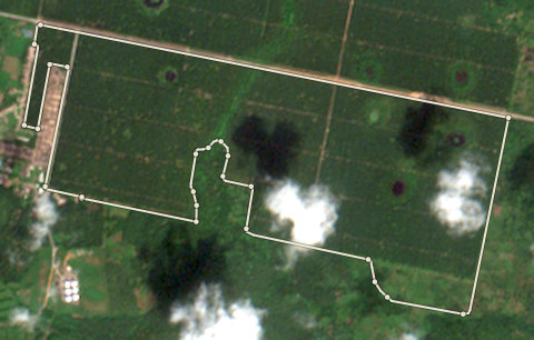
Proof pack

The files an EU buyer would receive.

Built from this run. Farms that are Stop, unchecked or not reviewed are left out of the farm location file and listed. Bag weights are each farm's estimated season capacity (area times a published average yield), because no bags were bought from these farms.

Shipment S-001: Blocked

Something stops the handoff. Fix the blockers below.

  • Lot L-001 (2,689,098 kg) is not kept apart: 4 bag groups trace to a plot that is not cleared. Mixed goods cannot be fixed by leaving plots out of the farm location file. Take lot L-001 out of this shipment, or resolve its farms first.
  • 4 plots behind these goods are not in the farm location file: EDO-PML-0001 (Check, no one has accepted it), EDO-PML-0002 (Stop), EDO-PML-0003 (Check, no one has accepted it), EDO-PML-0004 (Check, no one has accepted it). The goods and the producer locations do not match. Resolve these plots, or take the lots that hold their bags out of the shipment.

Nobody approved this case's shipment. It is a real run on public map data, so there is no approval to show.

  1. 1. Satellite check: Clear, Check or Stop for each farm.
  2. 2. A person's review: Every Check, and every farm where the maps and Forestline AI disagree.
  3. 3. Traceability: Every bag traces to a cleared farm.
  4. 4. Shipment approval: Until someone approves the handoff, the pack is a draft.

Want this for your own farms? Get started or try a Check.